Building date: In 1852 the corner stone was laid - 10 years to complete in 1863, demolished 1936
Original use: Church - stopped being used as church in 1891.
Corner structures:
Mortar application and content:
Types and uses of stones:
Types and choice of windows:
Structures with similar masonry details:
Masons who worked on building: Members of the Dutch Reformed congregation.
Unique features:
Map views courtesy Google Maps. Approximate location provided by Google Earth; 43°13'54.02"N 77°08'30.05"W.
Town of Williamson and Wayne County 1978 Highway Maps
Dutch Reformed Church of E Williamson history sheet. From the personal research of cobblestone historian Karen Crandall.
 1858 Wayne County Wil-29 Excerpt Map.jpg ¹ | 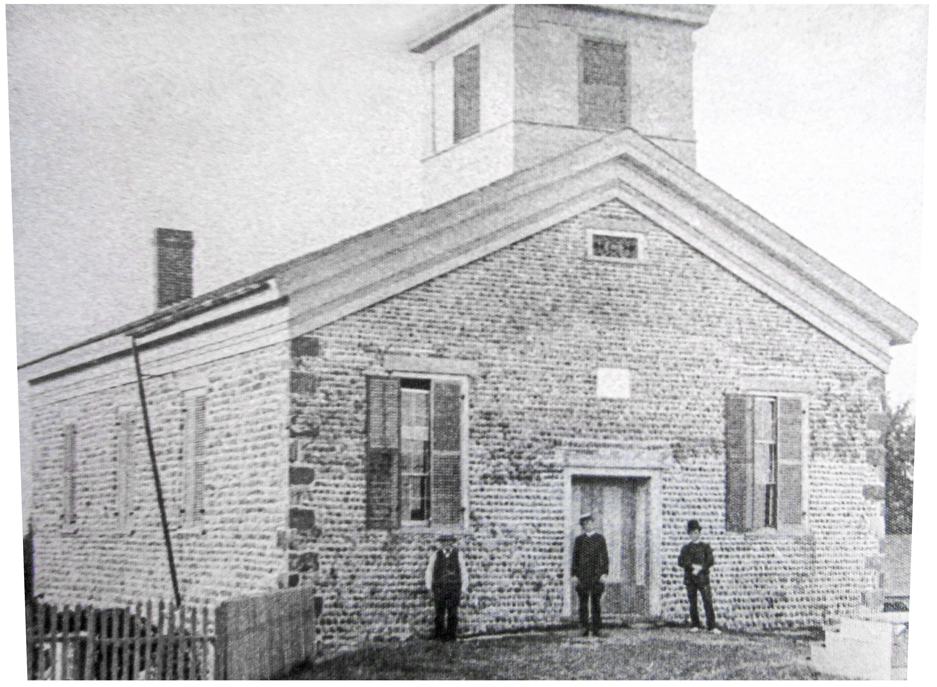 Reformed Church of East Williamson.jpg ² |  Wil-29 DeNagel 11-6-25.jpg ³ Fisher and Hartsen Hay & Straw |
¹ 1858 Wayne County Map Wil-29 Excerpt courtesy Library of Congress.
² Image courtesy Karen Crandall.
³ Image from collection of Craig DeNagel, Williamson NY.
